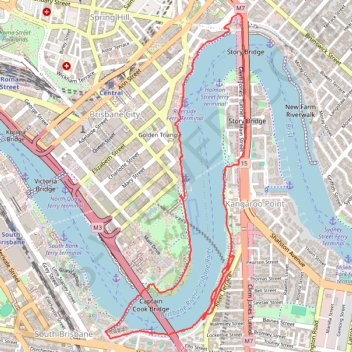
Kangaroo Point - Story Bridge - Goodwill Bridge
Interactive trail map
Trail profile
- Distance: 7.4 Km
- Elevation gain: 117 m
- Maximum elevation: 32 m
- Elevation loss: 113 m
- Minimum elevation: 2 m
- Moving time: 1 h 14 m
- Moving speed: 6.0 Km/h
- Maximum speed: 14.1 Km/h
- Total time: 1 h 16 m
- Global speed: 5.8 Km/h
About this trail
Name: Kangaroo Point - Story Bridge - Goodwill Bridge trail, distance, elevation, map, profile, GPS track
Start: River Terrace, Kangaroo Point, Greater Brisbane, Queensland, 4169, Australia (-27.47806 153.03447)
Coordinates: -27.48248 153.02547 -27.46122 153.03579
Other hiking, mountain biking, running and outdoor activity trails
Click on a trail to view its statistics, map and profile.