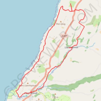
Llanrhystud Llanddeiniol loop walk
- Distance: 16.3 Km
- Elevation gain: 425 m
- Maximum elevation: 169 m
- Elevation loss: 426 m
- Minimum elevation: 6 m
- Moving time: 4 h 34 m
- Moving speed: 3.6 Km/h
- Maximum speed: 5.5 Km/h
- Total time: 7 h 20 m
- Global speed: 2.2 Km/h
Interactive trail map
Trail profile
- Distance: 16.3 Km
- Elevation gain: 425 m
- Maximum elevation: 169 m
- Elevation loss: 426 m
- Minimum elevation: 6 m
- Moving time: 4 h 34 m
- Moving speed: 3.6 Km/h
- Maximum speed: 5.5 Km/h
- Total time: 7 h 20 m
- Global speed: 2.2 Km/h
About this trail
Name: Llanrhystud Llanddeiniol loop walk trail, distance, elevation, map, profile, GPS track
Coordinates: 52.30351 -4.15697 52.34980 -4.10085