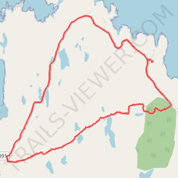
Loop hike across northern end of Applecross Peninsula
- Distance: 11.1 Km
- Elevation gain: 233 m
- Maximum elevation: 114 m
- Elevation loss: 235 m
- Minimum elevation: 15 m
Interactive trail map
Trail profile
- Distance: 11.1 Km
- Elevation gain: 233 m
- Maximum elevation: 114 m
- Elevation loss: 235 m
- Minimum elevation: 15 m
About this trail
Name: Loop hike across northern end of Applecross Peninsula trail, distance, elevation, map, profile, GPS track
Start: Fearnbeag Road, Fearnbeag, Highland, Scotland, IV54 8XU, United Kingdom (57.56933 -5.78658)
End: Fearnbeag Road, Fearnbeag, Highland, Scotland, IV54 8XU, United Kingdom (57.56951 -5.78638)
Coordinates: 57.55100 -5.83636 57.57782 -5.78011