Canal Run
Afternoon Run
- Distance: 4.8 Km
- Elevation gain: 6 m
- Maximum elevation: 40 m
- Elevation loss: 6 m
- Minimum elevation: 37 m
- Moving time: 34 m 28 s
- Moving speed: 8.3 Km/h
- Maximum speed: 19.0 Km/h
- Total time: 36 m 42 s
- Global speed: 7.8 Km/h
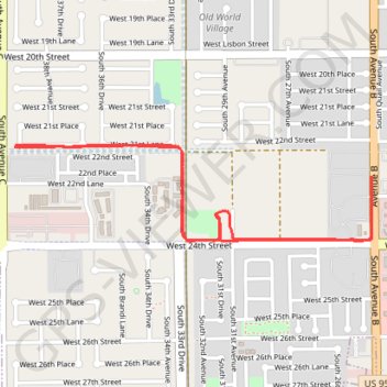
Interactive trail map
Trail profile
- Distance: 4.8 Km
- Elevation gain: 6 m
- Maximum elevation: 40 m
- Elevation loss: 6 m
- Minimum elevation: 37 m
- Moving time: 34 m 28 s
- Moving speed: 8.3 Km/h
- Maximum speed: 19.0 Km/h
- Total time: 36 m 42 s
- Global speed: 7.8 Km/h
About this trail
Name: Canal Run trail, distance, elevation, map, profile, GPS track
Start: Yuma, Yuma County, Arizona, 85364, United States (32.68762 -114.66686)
End: Yuma, Yuma County, Arizona, 85364, United States (32.68768 -114.66679)
Coordinates: 32.68400 -114.66686 32.68770 -114.65052