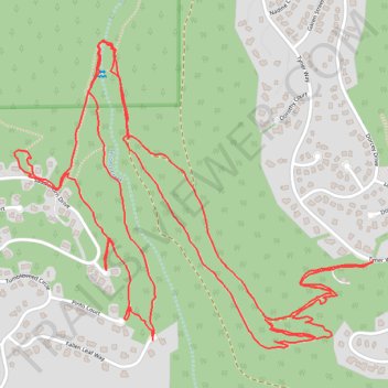
Trails near Second Creek
- Distance: 7.1 Km
- Elevation gain: 292 m
- Maximum elevation: 2,245 m
- Elevation loss: 291 m
- Minimum elevation: 2,109 m
- Moving time: 1 h 40 m
- Moving speed: 4.2 Km/h
- Maximum speed: 12.7 Km/h
- Total time: 1 h 45 m
- Global speed: 4.0 Km/h
Interactive trail map
Trail profile
- Distance: 7.1 Km
- Elevation gain: 292 m
- Maximum elevation: 2,245 m
- Elevation loss: 291 m
- Minimum elevation: 2,109 m
- Moving time: 1 h 40 m
- Moving speed: 4.2 Km/h
- Maximum speed: 12.7 Km/h
- Total time: 1 h 45 m
- Global speed: 4.0 Km/h
About this trail
Name: Trails near Second Creek trail, distance, elevation, map, profile, GPS track
Coordinates: 39.25969 -119.98134 39.26773 -119.96925