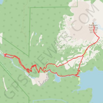
The Black Tusk - Garibaldi Lake
Interactive trail map
Trail profile
- Distance: 26.9 Km
- Elevation gain: 1,992 m
- Maximum elevation: 2,169 m
- Elevation loss: 1,984 m
- Minimum elevation: 565 m
About this trail
Name: The Black Tusk - Garibaldi Lake trail, distance, elevation, map, profile, GPS track
Coordinates: 49.94471 -123.12150 49.97384 -123.03731
Other hiking, mountain biking, running and outdoor activity trails
Click on a trail to view its statistics, map and profile.
Panorama Ridge
Canada > British Columbia > Squamish-Lillooet Regional District > Area D (Elaho/Garibaldi)
Garibaldi Provincial Park. #Hiking #PanoramaRidge #Garibaldi
Distance: 13.5 Km • Elevation gain: 1,666 m • Maximum elevation: 2,115 m