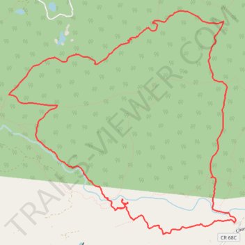
Elkhorn Creek area trails in Roosevelt National Forest
- Distance: 14.3 Km
- Elevation gain: 391 m
- Maximum elevation: 2,608 m
- Elevation loss: 391 m
- Minimum elevation: 2,373 m
- Moving time: 4 h 29 s
- Moving speed: 3.6 Km/h
- Maximum speed: 5.0 Km/h
- Total time: 5 h 27 m
- Global speed: 2.6 Km/h
Interactive trail map
Trail profile
- Distance: 14.3 Km
- Elevation gain: 391 m
- Maximum elevation: 2,608 m
- Elevation loss: 391 m
- Minimum elevation: 2,373 m
- Moving time: 4 h 29 s
- Moving speed: 3.6 Km/h
- Maximum speed: 5.0 Km/h
- Total time: 5 h 27 m
- Global speed: 2.6 Km/h
About this trail
Name: Elkhorn Creek area trails in Roosevelt National Forest trail, distance, elevation, map, profile, GPS track
Coordinates: 40.74459 -105.58035 40.77455 -105.54019