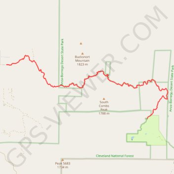
Lost Valley Road, Lost Valley Boy Scouts
- Distance: 14.9 Km
- Elevation gain: 378 m
- Maximum elevation: 1,633 m
- Elevation loss: 322 m
- Minimum elevation: 1,381 m
- Moving time: 47 m 52 s
- Moving speed: 18.7 Km/h
- Maximum speed: 37.6 Km/h
- Total time: 54 m 33 s
- Global speed: 16.4 Km/h
Interactive trail map
Trail profile
- Distance: 14.9 Km
- Elevation gain: 378 m
- Maximum elevation: 1,633 m
- Elevation loss: 322 m
- Minimum elevation: 1,381 m
- Moving time: 47 m 52 s
- Moving speed: 18.7 Km/h
- Maximum speed: 37.6 Km/h
- Total time: 54 m 33 s
- Global speed: 16.4 Km/h
About this trail
Name: Lost Valley Road, Lost Valley Boy Scouts trail, distance, elevation, map, profile, GPS track
Start: 31426, Lost Valley Road, San Diego County, California, 92086, United States (33.38460 -116.64624)
Coordinates: 33.35993 -116.64624 33.38885 -116.55835