Spring Creek Nature Trail
Mountain Bike along the Spring Creek via George Mitchel Nature Preserve. #MTB #River #Forest #Lake #Nature
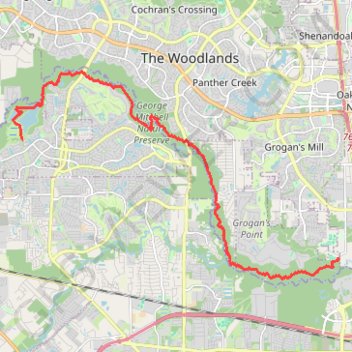
- Distance: 21.8 Km
- Elevation gain: 78 m
- Maximum elevation: 48 m
- Elevation loss: 68 m
- Minimum elevation: 28 m
- Moving time: 12 h 54 m
- Moving speed: 1.7 Km/h
- Maximum speed: 2.3 Km/h
- Total time: 2 d 4 h
- Global speed: 0.4 Km/h
Interactive trail map
Trail profile
- Distance: 21.8 Km
- Elevation gain: 78 m
- Maximum elevation: 48 m
- Elevation loss: 68 m
- Minimum elevation: 28 m
- Moving time: 12 h 54 m
- Moving speed: 1.7 Km/h
- Maximum speed: 2.3 Km/h
- Total time: 2 d 4 h
- Global speed: 0.4 Km/h
About this trail
Name: Spring Creek Nature Trail trail, distance, elevation, map, profile, GPS track
Coordinates: 30.10538 -95.56728 30.16885 -95.45172