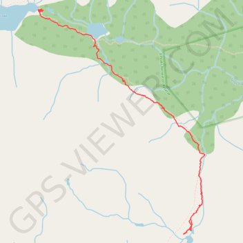
Owl-Tenquille traverse south of Ogre Lake
- Distance: 3.7 Km
- Elevation gain: 117 m
- Maximum elevation: 1,818 m
- Elevation loss: 236 m
- Minimum elevation: 1,655 m
- Moving time: 1 h 33 m
- Moving speed: 2.4 Km/h
- Maximum speed: 5.5 Km/h
- Total time: 2 h 55 m
- Global speed: 1.3 Km/h
Interactive trail map
Trail profile
- Distance: 3.7 Km
- Elevation gain: 117 m
- Maximum elevation: 1,818 m
- Elevation loss: 236 m
- Minimum elevation: 1,655 m
- Moving time: 1 h 33 m
- Moving speed: 2.4 Km/h
- Maximum speed: 5.5 Km/h
- Total time: 2 h 55 m
- Global speed: 1.3 Km/h
About this trail
Name: Owl-Tenquille traverse south of Ogre Lake trail, distance, elevation, map, profile, GPS track
Coordinates: 50.46855 -122.85759 50.48634 -122.83683
Other hiking, mountain biking, running and outdoor activity trails
Click on a trail to view its statistics, map and profile.