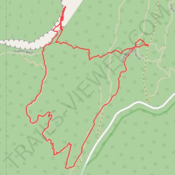
Grafton Wash Springs
- Distance: 3.7 Km
- Elevation gain: 153 m
- Maximum elevation: 1,475 m
- Elevation loss: 153 m
- Minimum elevation: 1,346 m
- Moving time: 1 h 22 m
- Moving speed: 2.7 Km/h
- Maximum speed: 5.4 Km/h
- Total time: 2 h 58 m
- Global speed: 1.2 Km/h
Interactive trail map
Trail profile
- Distance: 3.7 Km
- Elevation gain: 153 m
- Maximum elevation: 1,475 m
- Elevation loss: 153 m
- Minimum elevation: 1,346 m
- Moving time: 1 h 22 m
- Moving speed: 2.7 Km/h
- Maximum speed: 5.4 Km/h
- Total time: 2 h 58 m
- Global speed: 1.2 Km/h
About this trail
Name: Grafton Wash Springs trail, distance, elevation, map, profile, GPS track
Start: Connector, Washington County, Utah, United States (37.13361 -113.09804)
End: Connector, Washington County, Utah, United States (37.13360 -113.09807)
Coordinates: 37.12760 -113.10556 37.13553 -113.09804