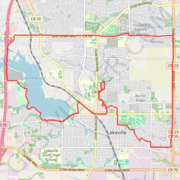
Lakewood
- Distance: 23.8 Km
- Elevation gain: 160 m
- Maximum elevation: 338 m
- Elevation loss: 160 m
- Minimum elevation: 291 m
- Moving time: 1 h 18 m
- Moving speed: 18.2 Km/h
- Maximum speed: 36.3 Km/h
- Total time: 1 h 27 m
- Global speed: 16.3 Km/h
Interactive trail map
Trail profile
- Distance: 23.8 Km
- Elevation gain: 160 m
- Maximum elevation: 338 m
- Elevation loss: 160 m
- Minimum elevation: 291 m
- Moving time: 1 h 18 m
- Moving speed: 18.2 Km/h
- Maximum speed: 36.3 Km/h
- Total time: 1 h 27 m
- Global speed: 16.3 Km/h
About this trail
Name: Lakewood trail, distance, elevation, map, profile, GPS track
Coordinates: 44.64513 -93.29340 44.68235 -93.21731