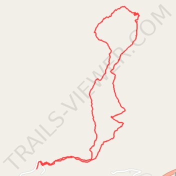
Lucy Braun Memorial Trail
- Distance: 5.9 Km
- Elevation gain: 316 m
- Maximum elevation: 720 m
- Elevation loss: 312 m
- Minimum elevation: 422 m
- Moving time: 1 h 28 m
- Moving speed: 4.0 Km/h
- Maximum speed: 21.4 Km/h
- Total time: 1 h 43 m
- Global speed: 3.4 Km/h
Interactive trail map
Trail profile
- Distance: 5.9 Km
- Elevation gain: 316 m
- Maximum elevation: 720 m
- Elevation loss: 312 m
- Minimum elevation: 422 m
- Moving time: 1 h 28 m
- Moving speed: 4.0 Km/h
- Maximum speed: 21.4 Km/h
- Total time: 1 h 43 m
- Global speed: 3.4 Km/h
About this trail
Name: Lucy Braun Memorial Trail trail, distance, elevation, map, profile, GPS track
Start: Camp Blanton Lane, Harlan County, Kentucky, 40824, United States (36.86128 -83.37951)
End: Camp Blanton Lane, Harlan County, Kentucky, 40824, United States (36.86191 -83.37904)
Coordinates: 36.86128 -83.37951 36.87511 -83.36858