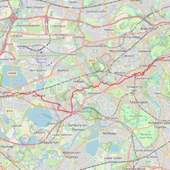
Staines to Richmond by bike
Interactive trail map
Trail profile
- Distance: 22.0 Km
- Elevation gain: 44 m
- Maximum elevation: 23 m
- Elevation loss: 49 m
- Minimum elevation: 7 m
About this trail
Name: Staines to Richmond by bike trail, distance, elevation, map, profile, GPS track
Coordinates: 51.41943 -0.50348 51.46328 -0.30206