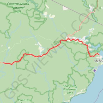
Drummer Creek - Alfred National Park - Mallacoota
Interactive trail map
Trail profile
- Distance: 57.7 Km
- Elevation gain: 769 m
- Maximum elevation: 321 m
- Elevation loss: 856 m
- Minimum elevation: 1 m
About this trail
Name: Drummer Creek - Alfred National Park - Mallacoota trail, distance, elevation, map, profile, GPS track
Start: Drummer Track, Noorinbee, Shire of East Gippsland, Victoria, 3890, Australia (-37.56919 149.27208)
End: Mallacoota, Shire of East Gippsland, Victoria, 3892, Australia (-37.53838 149.74209)
Coordinates: -37.57627 149.27111 -37.47458 149.74268
Other hiking, mountain biking, running and outdoor activity trails
Click on a trail to view its statistics, map and profile.
Mallacoota - Tura Beach
Australia > Victoria > Mallacoota
#Bike
Distance: 121.7 Km • Elevation gain: 2,063 m • Maximum elevation: 163 m