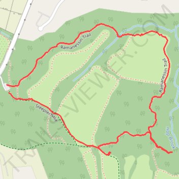
Holmdel Park
- Distance: 2.2 Km
- Elevation gain: 29 m
- Maximum elevation: 60 m
- Elevation loss: 32 m
- Minimum elevation: 32 m
- Moving time: 31 m 46 s
- Moving speed: 4.2 Km/h
- Maximum speed: 8.0 Km/h
- Total time: 47 m 47 s
- Global speed: 2.8 Km/h
Interactive trail map
Trail profile
- Distance: 2.2 Km
- Elevation gain: 29 m
- Maximum elevation: 60 m
- Elevation loss: 32 m
- Minimum elevation: 32 m
- Moving time: 31 m 46 s
- Moving speed: 4.2 Km/h
- Maximum speed: 8.0 Km/h
- Total time: 47 m 47 s
- Global speed: 2.8 Km/h
About this trail
Name: Holmdel Park trail, distance, elevation, map, profile, GPS track
Coordinates: 40.36315 -74.18371 40.36751 -74.17648