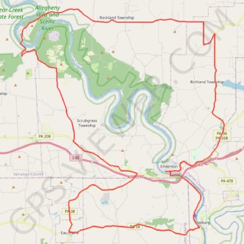
Bike Loop from Emlenton
Interactive trail map
Trail profile
- Distance: 73.8 Km
- Elevation gain: 1,282 m
- Maximum elevation: 476 m
- Elevation loss: 1,278 m
- Minimum elevation: 264 m
About this trail
Name: Bike Loop from Emlenton trail, distance, elevation, map, profile, GPS track
Start: Emlenton, Venango County, Pennsylvania, 16373, United States (41.17730 -79.71279)
Coordinates: 41.13460 -79.84214 41.28608 -79.66056