Northern Rail Trail: Lebanon - Mud Pond/Canaan
- Distance: 50.4 Km
- Elevation gain: 542 m
- Maximum elevation: 297 m
- Elevation loss: 542 m
- Minimum elevation: 160 m
- Moving time: 2 h 51 m
- Moving speed: 17.6 Km/h
- Maximum speed: 27.5 Km/h
- Total time: 2 h 59 m
- Global speed: 16.9 Km/h
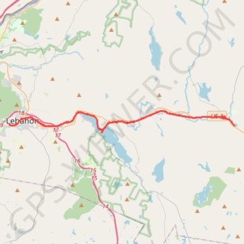
Interactive trail map
Trail profile
- Distance: 50.4 Km
- Elevation gain: 542 m
- Maximum elevation: 297 m
- Elevation loss: 542 m
- Minimum elevation: 160 m
- Moving time: 2 h 51 m
- Moving speed: 17.6 Km/h
- Maximum speed: 27.5 Km/h
- Total time: 2 h 59 m
- Global speed: 16.9 Km/h
About this trail
Name: Northern Rail Trail: Lebanon - Mud Pond/Canaan trail, distance, elevation, map, profile, GPS track
Coordinates: 43.63240 -72.26708 43.65116 -71.99854
Other hiking, mountain biking, running and outdoor activity trails
Click on a trail to view its statistics, map and profile.
Crystal Lake Trail
United States > New Hampshire > Grafton County > Enfield
Distance: 22.4 Km • Elevation gain: 357 m • Maximum elevation: 345 m