E-Mountain Bike Ride: Iron Keld & Hodge Close
- Distance: 20.9 Km
- Elevation gain: 588 m
- Maximum elevation: 271 m
- Elevation loss: 588 m
- Minimum elevation: 70 m
- Moving time: 1 h 11 m
- Moving speed: 17.6 Km/h
- Maximum speed: 49.5 Km/h
- Total time: 1 h 17 m
- Global speed: 16.2 Km/h
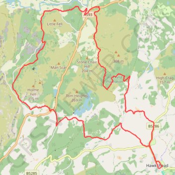
Interactive trail map
Trail profile
- Distance: 20.9 Km
- Elevation gain: 588 m
- Maximum elevation: 271 m
- Elevation loss: 588 m
- Minimum elevation: 70 m
- Moving time: 1 h 11 m
- Moving speed: 17.6 Km/h
- Maximum speed: 49.5 Km/h
- Total time: 1 h 17 m
- Global speed: 16.2 Km/h
About this trail
Name: E-Mountain Bike Ride: Iron Keld & Hodge Close trail, distance, elevation, map, profile, GPS track
Coordinates: 54.37385 -3.06598 54.41769 -2.99634
Other hiking, mountain biking, running and outdoor activity trails
Click on a trail to view its statistics, map and profile.
Hiking
United Kingdom > England > Westmorland and Furness > Holme Ground
Distance: 1.5 Km • Elevation gain: 28 m • Maximum elevation: 195 m