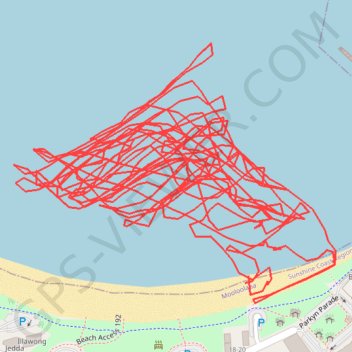
Afternoon Surfing
- Distance: 14.6 Km
- Elevation gain: 6 m
- Maximum elevation: 4 m
- Elevation loss: 6 m
- Minimum elevation: 0 m
- Moving time: 1 h 1 m
- Moving speed: 14.3 Km/h
- Maximum speed: 51.0 Km/h
- Total time: 1 h 14 m
- Global speed: 11.8 Km/h
Interactive trail map
Trail profile
- Distance: 14.6 Km
- Elevation gain: 6 m
- Maximum elevation: 4 m
- Elevation loss: 6 m
- Minimum elevation: 0 m
- Moving time: 1 h 1 m
- Moving speed: 14.3 Km/h
- Maximum speed: 51.0 Km/h
- Total time: 1 h 14 m
- Global speed: 11.8 Km/h
About this trail
Name: Afternoon Surfing trail, distance, elevation, map, profile, GPS track
Coordinates: -26.68398 153.12694 -26.68010 153.13228