Cathedral Range - Neds Peak
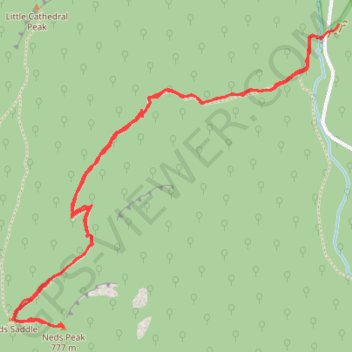
Interactive trail map
Trail profile
- Distance: 5.5 Km
- Elevation gain: 447 m
- Maximum elevation: 747 m
- Elevation loss: 447 m
- Minimum elevation: 300 m
About this trail
Name: Cathedral Range - Neds Peak trail, distance, elevation, map, profile, GPS track
Start: Little River Track, Taggerty, Shire of Murrindindi, Victoria, 3714, Australia (-37.35598 145.75275)
Coordinates: -37.36734 145.73746 -37.35548 145.75350
Other hiking, mountain biking, running and outdoor activity trails
Click on a trail to view its statistics, map and profile.
Tallarook - Eildon - Hurstbridge
Australia > Victoria > Tallarook
#Bike
Distance: 278.8 Km • Elevation gain: 4,897 m • Maximum elevation: 868 m
Cathedral Ranges and Neds Peak loop hike
Distance: 14.6 Km • Elevation gain: 721 m • Maximum elevation: 825 m
Cathedral Range State Park
Australia > Victoria > Rubicon
Distance: 16.9 Km • Elevation gain: 780 m • Maximum elevation: 920 m
The cathedral and the jawbones
Distance: 12.6 Km • Elevation gain: 632 m • Maximum elevation: 817 m
Cathedral Range - Neds Peak
Distance: 5.5 Km • Elevation gain: 447 m • Maximum elevation: 747 m