Weedon Island Preserve Loop via Tower Boardwalk, Bay Observation Platform, Look Point and Boy Scout Trail
The Weedon Island Preserve Loop offers a scenic and diverse hiking experience through wetlands, coastal forests, and mangrove swamps. As you walk along the boardwalks and trails, you'll encounter expansive views of Tampa Bay, saltwater ponds, and the surrounding forest, while also spotting a variety of wildlife such as wading birds and fish. The route's observation platforms and the 45-foot tower provide excellent vantage points for appreciating the preserve's beauty and the surrounding natural landscape. #Hiking #Loop #Sea #Overlook #Forest #Nature
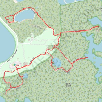
- Distance: 7.4 Km
- Elevation gain: 17 m
- Maximum elevation: 6 m
- Elevation loss: 16 m
- Minimum elevation: 1 m
- Moving time: 1 h 50 m
- Moving speed: 4.0 Km/h
- Maximum speed: 9.7 Km/h
- Total time: 2 h 21 m
- Global speed: 3.1 Km/h
Interactive trail map
Trail profile
- Distance: 7.4 Km
- Elevation gain: 17 m
- Maximum elevation: 6 m
- Elevation loss: 16 m
- Minimum elevation: 1 m
- Moving time: 1 h 50 m
- Moving speed: 4.0 Km/h
- Maximum speed: 9.7 Km/h
- Total time: 2 h 21 m
- Global speed: 3.1 Km/h
About this trail
Name: Weedon Island Preserve Loop via Tower Boardwalk, Bay Observation Platform, Look Point and Boy Scout Trail trail, distance, elevation, map, profile, GPS track
Start: Upland Trail, Saint Petersburg, Pinellas County, Florida, 33703, United States (27.84711 -82.60804)
End: Upland Trail, Saint Petersburg, Pinellas County, Florida, 33703, United States (27.84745 -82.60788)
Coordinates: 27.84418 -82.60981 27.85413 -82.59766