2018-06-30 09:01:03 Dan
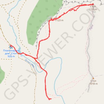
- Distance: 5.6 Km
- Elevation gain: 398 m
- Maximum elevation: 1,148 m
- Elevation loss: 397 m
- Minimum elevation: 813 m
- Moving time: 2 h 41 m
- Moving speed: 2.1 Km/h
- Maximum speed: 5.8 Km/h
- Total time: 3 h 56 m
- Global speed: 1.4 Km/h
Interactive trail map
Trail profile
- Distance: 5.6 Km
- Elevation gain: 398 m
- Maximum elevation: 1,148 m
- Elevation loss: 397 m
- Minimum elevation: 813 m
- Moving time: 2 h 41 m
- Moving speed: 2.1 Km/h
- Maximum speed: 5.8 Km/h
- Total time: 3 h 56 m
- Global speed: 1.4 Km/h
About this trail
Name: 2018-06-30 09:01:03 Dan trail, distance, elevation, map, profile, GPS track
Coordinates: 44.16605 22.12374 44.17824 22.13838