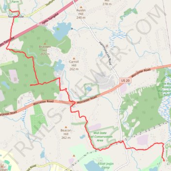
Walking Little River to Midstate Trail through Charlton all the way to Fay Mountain Farm, on CHPT hike
- Distance: 8.6 Km
- Elevation gain: 170 m
- Maximum elevation: 272 m
- Elevation loss: 97 m
- Minimum elevation: 161 m
- Moving time: 2 h 25 m
- Moving speed: 3.5 Km/h
- Maximum speed: 9.2 Km/h
- Total time: 2 h 51 m
- Global speed: 3.0 Km/h
Interactive trail map
Trail profile
- Distance: 8.6 Km
- Elevation gain: 170 m
- Maximum elevation: 272 m
- Elevation loss: 97 m
- Minimum elevation: 161 m
- Moving time: 2 h 25 m
- Moving speed: 3.5 Km/h
- Maximum speed: 9.2 Km/h
- Total time: 2 h 51 m
- Global speed: 3.0 Km/h
About this trail
Name: Walking Little River to Midstate Trail through Charlton all the way to Fay Mountain Farm, on CHPT hike trail, distance, elevation, map, profile, GPS track
Coordinates: 42.13505 -71.95569 42.16614 -71.91180