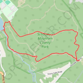
Boulder Gorge Loop Trail in Schooley's Mountain County Park
The Boulder Gorge Loop Trail offers a refreshing hike through New Jersey’s lush woodlands, leading past cascading waterfalls, rugged rock formations, and Lake George. The trail provides a scenic mix of forested paths and rocky sections that meander along Electric Brook, with viewpoints overlooking the gorge and valley. This moderately challenging route is ideal for hikers seeking a peaceful escape into nature while enjoying diverse landscapes and the occasional wildlife sightings. #Hiking #Loop #Gorge #Waterfall #Lake #Forest #Nature
- Distance: 3.8 Km
- Elevation gain: 173 m
- Maximum elevation: 325 m
- Elevation loss: 173 m
- Minimum elevation: 184 m
- Moving time: 1 h 10 m
- Moving speed: 3.2 Km/h
- Maximum speed: 8.1 Km/h
- Total time: 1 h 17 m
- Global speed: 2.9 Km/h
Interactive trail map
Trail profile
- Distance: 3.8 Km
- Elevation gain: 173 m
- Maximum elevation: 325 m
- Elevation loss: 173 m
- Minimum elevation: 184 m
- Moving time: 1 h 10 m
- Moving speed: 3.2 Km/h
- Maximum speed: 8.1 Km/h
- Total time: 1 h 17 m
- Global speed: 2.9 Km/h
About this trail
Name: Boulder Gorge Loop Trail in Schooley's Mountain County Park trail, distance, elevation, map, profile, GPS track
Coordinates: 40.79458 -74.78446 40.80020 -74.77031