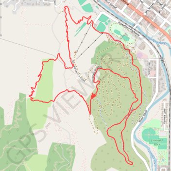
Morning Mountain Bike Ride
- Distance: 8.8 Km
- Elevation gain: 252 m
- Maximum elevation: 2,212 m
- Elevation loss: 252 m
- Minimum elevation: 2,047 m
- Moving time: 36 m 32 s
- Moving speed: 14.4 Km/h
- Maximum speed: 35.6 Km/h
- Total time: 37 m 47 s
- Global speed: 14.0 Km/h
Interactive trail map
Trail profile
- Distance: 8.8 Km
- Elevation gain: 252 m
- Maximum elevation: 2,212 m
- Elevation loss: 252 m
- Minimum elevation: 2,047 m
- Moving time: 36 m 32 s
- Moving speed: 14.4 Km/h
- Maximum speed: 35.6 Km/h
- Total time: 37 m 47 s
- Global speed: 14.0 Km/h
About this trail
Name: Morning Mountain Bike Ride trail, distance, elevation, map, profile, GPS track
Coordinates: 40.46893 -106.84686 40.48520 -106.83162