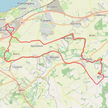
Fa'side Castle loop from Wallyford
- Distance: 34.3 Km
- Elevation gain: 355 m
- Maximum elevation: 136 m
- Elevation loss: 355 m
- Minimum elevation: 28 m
Interactive trail map
Trail profile
- Distance: 34.3 Km
- Elevation gain: 355 m
- Maximum elevation: 136 m
- Elevation loss: 355 m
- Minimum elevation: 28 m
About this trail
Name: Fa'side Castle loop from Wallyford trail, distance, elevation, map, profile, GPS track
Coordinates: 55.88917 -3.01774 55.94156 -2.86330
Other hiking, mountain biking, running and outdoor activity trails
Click on a trail to view its statistics, map and profile.
Running near Haddington
United Kingdom > Scotland > East Lothian > Haddington
Distance: 15.9 Km • Elevation gain: 103 m • Maximum elevation: 112 m