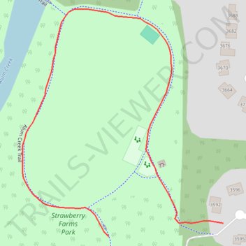
Strawberry Farms Park Loop
- Distance: 0.6 Km
- Elevation gain: 3 m
- Maximum elevation: 245 m
- Elevation loss: 6 m
- Minimum elevation: 240 m
- Moving time: 8 m 30 s
- Moving speed: 4.5 Km/h
- Maximum speed: 6.2 Km/h
- Total time: 8 m 30 s
- Global speed: 4.5 Km/h
Interactive trail map
Trail profile
- Distance: 0.6 Km
- Elevation gain: 3 m
- Maximum elevation: 245 m
- Elevation loss: 6 m
- Minimum elevation: 240 m
- Moving time: 8 m 30 s
- Moving speed: 4.5 Km/h
- Maximum speed: 6.2 Km/h
- Total time: 8 m 30 s
- Global speed: 4.5 Km/h
About this trail
Name: Strawberry Farms Park Loop trail, distance, elevation, map, profile, GPS track
End: Alum Creek Trail, Columbus, Sharon, Franklin County, Ohio, 43231, United States (40.07202 -82.91995)
Coordinates: 40.07202 -82.92095 40.07404 -82.91862