RE SO320930
- Distance: 2.9 Km
- Elevation gain: 113 m
- Maximum elevation: 231 m
- Elevation loss: 133 m
- Minimum elevation: 205 m
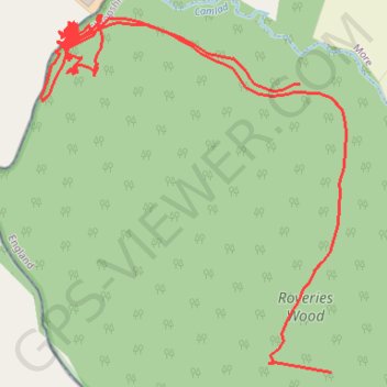
Interactive trail map
Trail profile
- Distance: 2.9 Km
- Elevation gain: 113 m
- Maximum elevation: 231 m
- Elevation loss: 133 m
- Minimum elevation: 205 m
About this trail
Name: RE SO320930 trail, distance, elevation, map, profile, GPS track
Start: Owl's Lane, Owlbury, Lydham, Shropshire, England, SY9 5HQ, United Kingdom (52.52681 -2.99746)
End: Hyssington, More, Shropshire, England, SY15 6EF, United Kingdom (52.53054 -2.99812)
Coordinates: 52.52681 -3.00365 52.53145 -2.99713
Other hiking, mountain biking, running and outdoor activity trails
Click on a trail to view its statistics, map and profile.
Bridges to Bishops Castle
United Kingdom > England > Shropshire > Bridges
Distance: 18.9 Km • Elevation gain: 548 m • Maximum elevation: 527 m