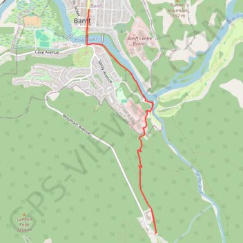
Bow Falls - Bow River - Banff
Interactive trail map
Trail profile
- Distance: 7.8 Km
- Elevation gain: 261 m
- Maximum elevation: 1,563 m
- Elevation loss: 261 m
- Minimum elevation: 1,360 m
About this trail
Name: Bow Falls - Bow River - Banff trail, distance, elevation, map, profile, GPS track
Coordinates: 51.14937 -115.57115 51.17646 -115.55783
Other hiking, mountain biking, running and outdoor activity trails
Click on a trail to view its statistics, map and profile.
Goat Creek Trail
Canada > Alberta > Kananaskis Improvement District
Spray Valley Provincial Park. Banff National Park. #Hiking #MTB #Snowshoeing #Ski #SprayValley #Banff
Distance: 37.4 Km • Elevation gain: 769 m • Maximum elevation: 1,668 m