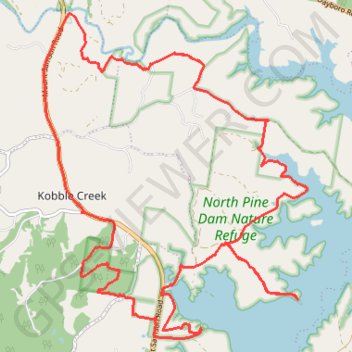
Kobble Creek - North Pine Dam
Interactive trail map
Trail profile
- Distance: 28.5 Km
- Elevation gain: 406 m
- Maximum elevation: 96 m
- Elevation loss: 407 m
- Minimum elevation: 37 m
About this trail
Name: Kobble Creek - North Pine Dam trail, distance, elevation, map, profile, GPS track
Coordinates: -27.26982 152.82972 -27.21621 152.87867
Other hiking, mountain biking, running and outdoor activity trails
Click on a trail to view its statistics, map and profile.
Kobble Creek - Lake Samsonvale
North Pine Dam Nature Reserve. #MTB #Loop #NorthPine #Kobble #Samsonvale
Distance: 24.1 Km • Elevation gain: 292 m • Maximum elevation: 75 m