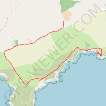
Lantivet Bay
Loop hike along Lantivet Bay in the Cornwall National Landscape. #Hiking #Sea #Channel #Nature #Cornwall
- Distance: 4.0 Km
- Elevation gain: 185 m
- Maximum elevation: 119 m
- Elevation loss: 150 m
- Minimum elevation: 0 m
- Moving time: 1 h 24 m
- Moving speed: 2.8 Km/h
- Maximum speed: 5.6 Km/h
- Total time: 1 h 44 m
- Global speed: 2.3 Km/h
Interactive trail map
Trail profile
- Distance: 4.0 Km
- Elevation gain: 185 m
- Maximum elevation: 119 m
- Elevation loss: 150 m
- Minimum elevation: 0 m
- Moving time: 1 h 24 m
- Moving speed: 2.8 Km/h
- Maximum speed: 5.6 Km/h
- Total time: 1 h 44 m
- Global speed: 2.3 Km/h
About this trail
Name: Lantivet Bay trail, distance, elevation, map, profile, GPS track
Start: Raphael Road, Raphael, Polperro, Cornwall, England, PL13 2PS, United Kingdom (50.33232 -4.58272)
Coordinates: 50.32753 -4.60352 50.33614 -4.58253