Tossal d'Escobidieso - Pic de Baserca - Punta Senyalada
- Distance: 16.9 Km
- Elevation gain: 1,763 m
- Maximum elevation: 2,934 m
- Elevation loss: 1,762 m
- Minimum elevation: 1,506 m
- Moving time: 7 h 51 m
- Moving speed: 2.2 Km/h
- Maximum speed: 6.7 Km/h
- Total time: 9 h 54 m
- Global speed: 1.7 Km/h
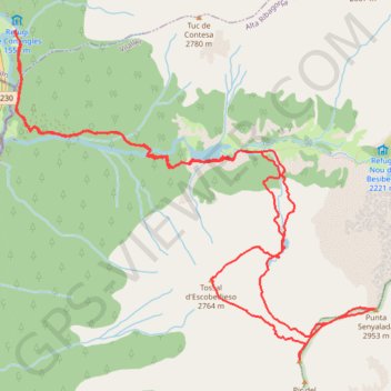
Interactive trail map
Trail profile
- Distance: 16.9 Km
- Elevation gain: 1,763 m
- Maximum elevation: 2,934 m
- Elevation loss: 1,762 m
- Minimum elevation: 1,506 m
- Moving time: 7 h 51 m
- Moving speed: 2.2 Km/h
- Maximum speed: 6.7 Km/h
- Total time: 9 h 54 m
- Global speed: 1.7 Km/h
About this trail
Name: Tossal d'Escobidieso - Pic de Baserca - Punta Senyalada trail, distance, elevation, map, profile, GPS track
Start: N-230, Vielha e Mijaran, Val d'Aran, Lleida, Catalonia, 25530, Spain (42.61442 0.76793)
End: N-230, Vielha e Mijaran, Val d'Aran, Lleida, Catalonia, 25530, Spain (42.61440 0.76809)
Coordinates: 42.58711 0.76792 42.61442 0.80848
Other hiking, mountain biking, running and outdoor activity trails
Click on a trail to view its statistics, map and profile.
GR 10 - Traversée des Pyrénées
France > Occitania > Pyrénées-Orientales > Banyuls-sur-Mer
Distance: 874.8 Km • Elevation gain: 57,000 m • Maximum elevation: 2,599 m
1 LUCENA - MONTPELLIER
Distance: 2,964.4 Km • Elevation gain: 29,500 m • Maximum elevation: 1,048 m
Southern section — European Divide Trail
France > Auvergne-Rhône-Alpes > Drôme > Valence
Distance: 2,423.8 Km • Elevation gain: 42,375 m • Maximum elevation: 2,005 m