Skippack Creek Loop Trail in Evansburg State Park
The Skippack Creek Loop Trail offers a scenic experience that combines woodland beauty with the tranquility of creek-side views. As you traverse the loop, you'll encounter charming wooden bridges, sections of the trail that wind alongside the Skippack Creek, and open fields filled with wildflowers, particularly delightful in spring. Although the trail includes a brief stretch along a road, the overall experience is enhanced by the park's natural splendor and the opportunity to spot wildlife. #Hiking #Loop #River #Forest #Nature
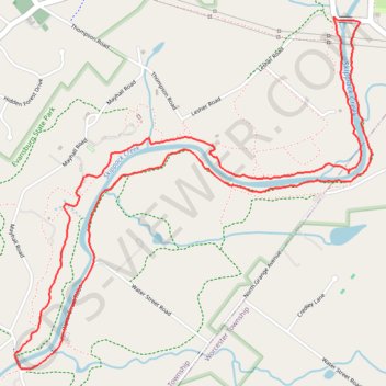
- Distance: 7.4 Km
- Elevation gain: 81 m
- Maximum elevation: 67 m
- Elevation loss: 82 m
- Minimum elevation: 40 m
- Moving time: 1 h 33 m
- Moving speed: 4.8 Km/h
- Maximum speed: 6.9 Km/h
- Total time: 1 h 36 m
- Global speed: 4.6 Km/h
Interactive trail map
Trail profile
- Distance: 7.4 Km
- Elevation gain: 81 m
- Maximum elevation: 67 m
- Elevation loss: 82 m
- Minimum elevation: 40 m
- Moving time: 1 h 33 m
- Moving speed: 4.8 Km/h
- Maximum speed: 6.9 Km/h
- Total time: 1 h 36 m
- Global speed: 4.6 Km/h
About this trail
Name: Skippack Creek Loop Trail in Evansburg State Park trail, distance, elevation, map, profile, GPS track
Coordinates: 40.18886 -75.40844 40.20522 -75.38677