Butte Gravel/Unpaved Cycling
- Distance: 45.6 Km
- Elevation gain: 1,454 m
- Maximum elevation: 2,272 m
- Elevation loss: 1,454 m
- Minimum elevation: 1,710 m
- Moving time: 3 h 6 m
- Moving speed: 14.6 Km/h
- Maximum speed: 47.5 Km/h
- Total time: 3 h 17 m
- Global speed: 13.8 Km/h
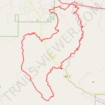
Interactive trail map
Trail profile
- Distance: 45.6 Km
- Elevation gain: 1,454 m
- Maximum elevation: 2,272 m
- Elevation loss: 1,454 m
- Minimum elevation: 1,710 m
- Moving time: 3 h 6 m
- Moving speed: 14.6 Km/h
- Maximum speed: 47.5 Km/h
- Total time: 3 h 17 m
- Global speed: 13.8 Km/h
About this trail
Name: Butte Gravel/Unpaved Cycling trail, distance, elevation, map, profile, GPS track
Start: Butte, Silver Bow County, Montana, United States (45.88894 -112.47163)
End: Butte, Silver Bow County, Montana, United States (45.88895 -112.47164)
Coordinates: 45.82287 -112.49320 45.91967 -112.40457