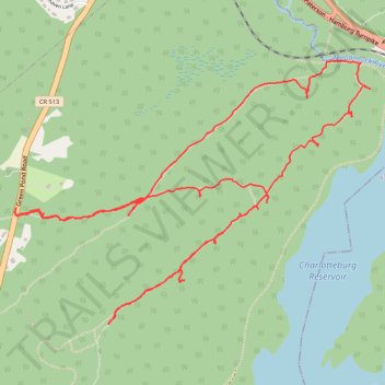
Loop hike via Four Birds Trail above Charlotteburg Reservoir - Newark Watershed
- Distance: 9.6 Km
- Elevation gain: 260 m
- Maximum elevation: 355 m
- Elevation loss: 260 m
- Minimum elevation: 233 m
- Moving time: 3 h 53 m
- Moving speed: 2.5 Km/h
- Maximum speed: 6.6 Km/h
- Total time: 5 h 45 m
- Global speed: 1.7 Km/h
Interactive trail map
Trail profile
- Distance: 9.6 Km
- Elevation gain: 260 m
- Maximum elevation: 355 m
- Elevation loss: 260 m
- Minimum elevation: 233 m
- Moving time: 3 h 53 m
- Moving speed: 2.5 Km/h
- Maximum speed: 6.6 Km/h
- Total time: 5 h 45 m
- Global speed: 1.7 Km/h
About this trail
Name: Loop hike via Four Birds Trail above Charlotteburg Reservoir - Newark Watershed trail, distance, elevation, map, profile, GPS track
Coordinates: 41.02395 -74.45412 41.03777 -74.42940