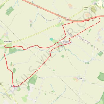
Uppington Circular walk from Uckington
- Distance: 10.9 Km
- Elevation gain: 108 m
- Maximum elevation: 139 m
- Elevation loss: 109 m
- Minimum elevation: 67 m
- Moving time: 2 h 28 m
- Moving speed: 4.4 Km/h
- Maximum speed: 10.0 Km/h
- Total time: 2 h 47 m
- Global speed: 3.9 Km/h
Interactive trail map
Trail profile
- Distance: 10.9 Km
- Elevation gain: 108 m
- Maximum elevation: 139 m
- Elevation loss: 109 m
- Minimum elevation: 67 m
- Moving time: 2 h 28 m
- Moving speed: 4.4 Km/h
- Maximum speed: 10.0 Km/h
- Total time: 2 h 47 m
- Global speed: 3.9 Km/h
About this trail
Name: Uppington Circular walk from Uckington trail, distance, elevation, map, profile, GPS track
Start: B5061, Norton, Wroxeter, Shropshire, England, SY4 4UH, United Kingdom (52.67851 -2.62732)
End: B5061, Uckington, Uppington, Shropshire, England, TF6 5HQ, United Kingdom (52.68114 -2.62613)
Coordinates: 52.66690 -2.62732 52.69062 -2.57372