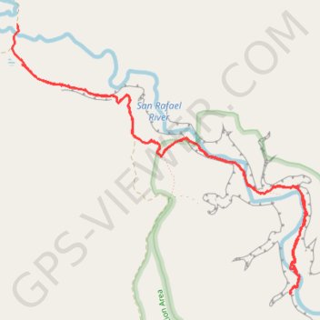
Fuller Bottom Little Grand Canyon San Rafael River
- Distance: 10.9 Km
- Elevation gain: 359 m
- Maximum elevation: 1,664 m
- Elevation loss: 361 m
- Minimum elevation: 1,597 m
- Moving time: 2 h 51 m
- Moving speed: 3.8 Km/h
- Maximum speed: 12.8 Km/h
- Total time: 3 h 23 m
- Global speed: 3.2 Km/h
Interactive trail map
Trail profile
- Distance: 10.9 Km
- Elevation gain: 359 m
- Maximum elevation: 1,664 m
- Elevation loss: 361 m
- Minimum elevation: 1,597 m
- Moving time: 2 h 51 m
- Moving speed: 3.8 Km/h
- Maximum speed: 12.8 Km/h
- Total time: 3 h 23 m
- Global speed: 3.2 Km/h
About this trail
Name: Fuller Bottom Little Grand Canyon San Rafael River trail, distance, elevation, map, profile, GPS track
Start: Little Wedge Road, Emery County, Utah, United States (39.11298 -110.85348)
End: Fuller Bottom Road, Emery County, Utah, United States (39.11632 -110.85401)
Coordinates: 39.09358 -110.85457 39.11635 -110.82253