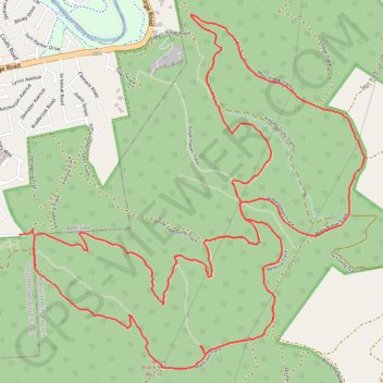
Black Hill Conservation Park Loop
Interactive trail map
Trail profile
- Distance: 11.7 Km
- Elevation gain: 692 m
- Maximum elevation: 477 m
- Elevation loss: 702 m
- Minimum elevation: 167 m
- Moving time: 3 h 53 s
- Moving speed: 3.9 Km/h
- Maximum speed: 10.4 Km/h
- Total time: 3 h 3 m
- Global speed: 3.8 Km/h
About this trail
Name: Black Hill Conservation Park Loop trail, distance, elevation, map, profile, GPS track
Coordinates: -34.88236 138.71179 -34.86148 138.73661