Scotchman Peak Trail in Kaniksu National Forest
The Scotchman Peak Trail offers a rewarding hiking experience characterized by steep inclines and breathtaking vistas. Along the route, hikers can enjoy expansive views of Lake Pend Oreille, the Clark Fork Valley, and the Selkirk Mountains, often spotting mountain goats in their natural habitat. The trail traverses diverse landscapes, including dense forests and rocky terrain, making it essential to come prepared for a challenging adventure. #Hiking #Mountain #Forest #Nature
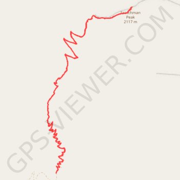
- Distance: 13.0 Km
- Elevation gain: 1,088 m
- Maximum elevation: 2,105 m
- Elevation loss: 1,087 m
- Minimum elevation: 1,017 m
- Moving time: 4 h 30 m
- Moving speed: 2.9 Km/h
- Maximum speed: 6.4 Km/h
- Total time: 5 h 48 m
- Global speed: 2.2 Km/h
Interactive trail map
Trail profile
- Distance: 13.0 Km
- Elevation gain: 1,088 m
- Maximum elevation: 2,105 m
- Elevation loss: 1,087 m
- Minimum elevation: 1,017 m
- Moving time: 4 h 30 m
- Moving speed: 2.9 Km/h
- Maximum speed: 6.4 Km/h
- Total time: 5 h 48 m
- Global speed: 2.2 Km/h
About this trail
Name: Scotchman Peak Trail in Kaniksu National Forest trail, distance, elevation, map, profile, GPS track
Start: Scotchman Peak Trail #65, Bonner County, Idaho, United States (48.16415 -116.09843)
End: Scotchman Peak Trail #65, Bonner County, Idaho, United States (48.16447 -116.09832)
Coordinates: 48.16415 -116.10037 48.18903 -116.08131