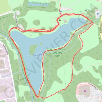
Arrow Valley Country Park Loop
- Distance: 5.0 Km
- Elevation gain: 24 m
- Maximum elevation: 86 m
- Elevation loss: 25 m
- Minimum elevation: 77 m
- Moving time: 31 m 12 s
- Moving speed: 9.6 Km/h
- Maximum speed: 16.5 Km/h
- Total time: 31 m 12 s
- Global speed: 9.6 Km/h
Interactive trail map
Trail profile
- Distance: 5.0 Km
- Elevation gain: 24 m
- Maximum elevation: 86 m
- Elevation loss: 25 m
- Minimum elevation: 77 m
- Moving time: 31 m 12 s
- Moving speed: 9.6 Km/h
- Maximum speed: 16.5 Km/h
- Total time: 31 m 12 s
- Global speed: 9.6 Km/h
About this trail
Name: Arrow Valley Country Park Loop trail, distance, elevation, map, profile, GPS track
Coordinates: 52.30110 -1.91630 52.30795 -1.90628