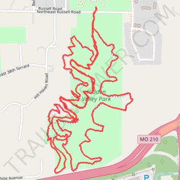
Hidden Valley Park
- Distance: 10.8 Km
- Elevation gain: 145 m
- Maximum elevation: 268 m
- Elevation loss: 146 m
- Minimum elevation: 241 m
- Moving time: 1 h 59 m
- Moving speed: 5.4 Km/h
- Maximum speed: 12.6 Km/h
- Total time: 2 h 2 m
- Global speed: 5.3 Km/h
Interactive trail map
Trail profile
- Distance: 10.8 Km
- Elevation gain: 145 m
- Maximum elevation: 268 m
- Elevation loss: 146 m
- Minimum elevation: 241 m
- Moving time: 1 h 59 m
- Moving speed: 5.4 Km/h
- Maximum speed: 12.6 Km/h
- Total time: 2 h 2 m
- Global speed: 5.3 Km/h
About this trail
Name: Hidden Valley Park trail, distance, elevation, map, profile, GPS track
Coordinates: 39.15539 -94.50963 39.16644 -94.50230