Raven Cliff Falls via Raven Cliffs Trail
The hike to Raven Cliff Falls offers a beautiful and moderately challenging trail through lush forested surroundings. Following Dodd Creek, the trail is alive with moss-covered trees, ferns, and seasonal wildflowers, making for an immersive and scenic journey toward the unique, double-streamed waterfall cascading through a granite cliff split. The path is well-loved for its peaceful atmosphere, punctuated by smaller waterfalls and the steady sound of running water, which enhance the sense of solitude and connection to nature as you approach the impressive 60-foot Raven Cliff Falls. #Hiking #Waterfall #River #Forest #Nature
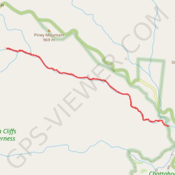
- Distance: 8.0 Km
- Elevation gain: 234 m
- Maximum elevation: 798 m
- Elevation loss: 234 m
- Minimum elevation: 616 m
- Moving time: 2 h 7 m
- Moving speed: 3.7 Km/h
- Maximum speed: 7.8 Km/h
- Total time: 2 h 35 m
- Global speed: 3.1 Km/h
Interactive trail map
Trail profile
- Distance: 8.0 Km
- Elevation gain: 234 m
- Maximum elevation: 798 m
- Elevation loss: 234 m
- Minimum elevation: 616 m
- Moving time: 2 h 7 m
- Moving speed: 3.7 Km/h
- Maximum speed: 7.8 Km/h
- Total time: 2 h 35 m
- Global speed: 3.1 Km/h
About this trail
Name: Raven Cliff Falls via Raven Cliffs Trail trail, distance, elevation, map, profile, GPS track
Start: White Oak Gap Road, White County, Georgia, United States (34.70980 -83.78925)
End: White Oak Gap Road, White County, Georgia, United States (34.70981 -83.78925)
Coordinates: 34.70980 -83.82329 34.72339 -83.78925
Other hiking, mountain biking, running and outdoor activity trails
Click on a trail to view its statistics, map and profile.