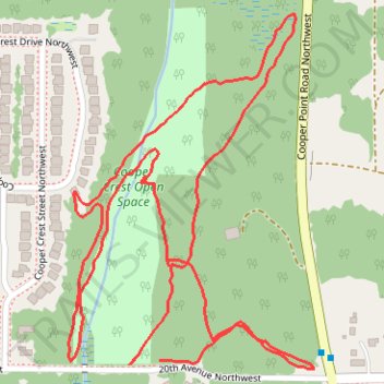
Cooper Crest Open Space Trails
- Distance: 2.7 Km
- Elevation gain: 57 m
- Maximum elevation: 92 m
- Elevation loss: 54 m
- Minimum elevation: 66 m
- Moving time: 51 m 59 s
- Moving speed: 3.2 Km/h
- Maximum speed: 17.3 Km/h
- Total time: 54 m 49 s
- Global speed: 3.0 Km/h
Interactive trail map
Trail profile
- Distance: 2.7 Km
- Elevation gain: 57 m
- Maximum elevation: 92 m
- Elevation loss: 54 m
- Minimum elevation: 66 m
- Moving time: 51 m 59 s
- Moving speed: 3.2 Km/h
- Maximum speed: 17.3 Km/h
- Total time: 54 m 49 s
- Global speed: 3.0 Km/h
About this trail
Name: Cooper Crest Open Space Trails trail, distance, elevation, map, profile, GPS track
Coordinates: 47.06322 -122.94706 47.06818 -122.94202