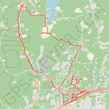
Charlestown - Long Run
- Distance: 24.1 Km
- Elevation gain: 213 m
- Maximum elevation: 60 m
- Elevation loss: 213 m
- Minimum elevation: 19 m
- Moving time: 2 h 7 m
- Moving speed: 11.3 Km/h
- Maximum speed: 16.2 Km/h
- Total time: 2 h 9 m
- Global speed: 11.2 Km/h
Interactive trail map
Trail profile
- Distance: 24.1 Km
- Elevation gain: 213 m
- Maximum elevation: 60 m
- Elevation loss: 213 m
- Minimum elevation: 19 m
- Moving time: 2 h 7 m
- Moving speed: 11.3 Km/h
- Maximum speed: 16.2 Km/h
- Total time: 2 h 9 m
- Global speed: 11.2 Km/h
About this trail
Name: Charlestown - Long Run trail, distance, elevation, map, profile, GPS track
Coordinates: 41.38939 -71.64868 41.42766 -71.61181