平托 大嶺峒北 五塊田坑
Hong Kong Hike
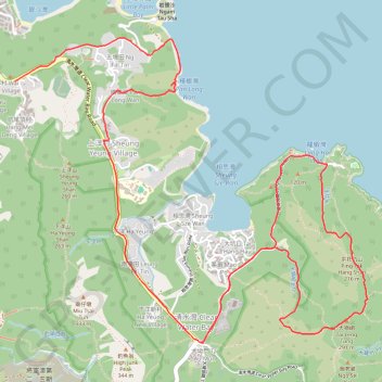
- Distance: 11.7 Km
- Elevation gain: 521 m
- Maximum elevation: 270 m
- Elevation loss: 533 m
- Minimum elevation: 0 m
- Moving time: 3 h 24 m
- Moving speed: 3.4 Km/h
- Maximum speed: 28.2 Km/h
- Total time: 6 h 2 m
- Global speed: 1.9 Km/h
Interactive trail map
Trail profile
- Distance: 11.7 Km
- Elevation gain: 521 m
- Maximum elevation: 270 m
- Elevation loss: 533 m
- Minimum elevation: 0 m
- Moving time: 3 h 24 m
- Moving speed: 3.4 Km/h
- Maximum speed: 28.2 Km/h
- Total time: 6 h 2 m
- Global speed: 1.9 Km/h
About this trail
Name: 平托 大嶺峒北 五塊田坑 trail, distance, elevation, map, profile, GPS track
Coordinates: 22.29597 114.27714 22.31835 114.30505