Emerald Lake via Pine River and Lake Creek - Weminuche Wilderness
Wilderness hike
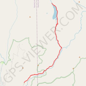
- Distance: 19.8 Km
- Elevation gain: 863 m
- Maximum elevation: 3,107 m
- Elevation loss: 210 m
- Minimum elevation: 2,411 m
- Moving time: 6 h 16 m
- Moving speed: 3.2 Km/h
- Maximum speed: 6.0 Km/h
- Total time: 7 h 35 m
- Global speed: 2.6 Km/h
Interactive trail map
Trail profile
- Distance: 19.8 Km
- Elevation gain: 863 m
- Maximum elevation: 3,107 m
- Elevation loss: 210 m
- Minimum elevation: 2,411 m
- Moving time: 6 h 16 m
- Moving speed: 3.2 Km/h
- Maximum speed: 6.0 Km/h
- Total time: 7 h 35 m
- Global speed: 2.6 Km/h
About this trail
Name: Emerald Lake via Pine River and Lake Creek - Weminuche Wilderness trail, distance, elevation, map, profile, GPS track
End: Lake Fork Trail (528), Hinsdale County, Colorado, United States (37.56774 -107.45256)
Coordinates: 37.44700 -107.50524 37.56774 -107.43327
Other hiking, mountain biking, running and outdoor activity trails
Click on a trail to view its statistics, map and profile.
Rock Creek Down
United States > Colorado > Hinsdale County
Wilderness hike
Distance: 17.6 Km • Elevation gain: 758 m • Maximum elevation: 3,812 m
Lake Creek Down
United States > Colorado > Hinsdale County
Distance: 16.8 Km • Elevation gain: 132 m • Maximum elevation: 3,557 m