Schoolhouse Mesa, Lake Fork Canyon and Rio Guadalupe Loop Ride from Gilman tunnels in Jemez National Recreation Area
- Distance: 54.9 Km
- Elevation gain: 901 m
- Maximum elevation: 2,635 m
- Elevation loss: 900 m
- Minimum elevation: 1,896 m
- Moving time: 3 h 56 m
- Moving speed: 14.0 Km/h
- Maximum speed: 44.3 Km/h
- Total time: 5 h 44 m
- Global speed: 9.6 Km/h
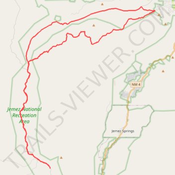
Interactive trail map
Trail profile
- Distance: 54.9 Km
- Elevation gain: 901 m
- Maximum elevation: 2,635 m
- Elevation loss: 900 m
- Minimum elevation: 1,896 m
- Moving time: 3 h 56 m
- Moving speed: 14.0 Km/h
- Maximum speed: 44.3 Km/h
- Total time: 5 h 44 m
- Global speed: 9.6 Km/h
About this trail
Name: Schoolhouse Mesa, Lake Fork Canyon and Rio Guadalupe Loop Ride from Gilman tunnels in Jemez National Recreation Area trail, distance, elevation, map, profile, GPS track
Start: Lake Fork Canyon Road, Sandoval County, New Mexico, United States (35.73777 -106.76492)
End: Lake Fork Canyon Road, Sandoval County, New Mexico, United States (35.73773 -106.76494)
Coordinates: 35.73773 -106.79533 35.86956 -106.65987
Other hiking, mountain biking, running and outdoor activity trails
Click on a trail to view its statistics, map and profile.
Alternative road to climb to top of 376
United States > New Mexico > Sandoval County
Distance: 58.9 Km • Elevation gain: 969 m • Maximum elevation: 2,635 m
Jemez MTB ride
United States > New Mexico > Sandoval County > O'Neil Landing
Lunch Mountain Bike Ride
Distance: 26.2 Km • Elevation gain: 862 m • Maximum elevation: 2,758 m