The Glendalough Hike - Wicklow Mountains National Park
- Distance: 18.9 Km
- Elevation gain: 636 m
- Maximum elevation: 503 m
- Elevation loss: 635 m
- Minimum elevation: 127 m
- Moving time: 4 h 29 m
- Moving speed: 4.2 Km/h
- Maximum speed: 7.1 Km/h
- Total time: 4 h 50 m
- Global speed: 3.9 Km/h
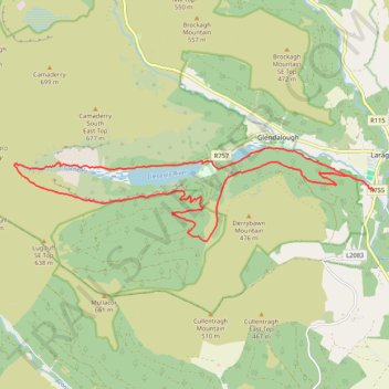
Interactive trail map
Trail profile
- Distance: 18.9 Km
- Elevation gain: 636 m
- Maximum elevation: 503 m
- Elevation loss: 635 m
- Minimum elevation: 127 m
- Moving time: 4 h 29 m
- Moving speed: 4.2 Km/h
- Maximum speed: 7.1 Km/h
- Total time: 4 h 50 m
- Global speed: 3.9 Km/h
About this trail
Name: The Glendalough Hike - Wicklow Mountains National Park trail, distance, elevation, map, profile, GPS track
Coordinates: 52.99406 -6.39820 53.00946 -6.29956
Other hiking, mountain biking, running and outdoor activity trails
Click on a trail to view its statistics, map and profile.
Moonlight Challenge
Distance: 26.0 Km • Elevation gain: 975 m • Maximum elevation: 506 m
Derrybawn Mountain Loop
Distance: 12.8 Km • Elevation gain: 448 m • Maximum elevation: 466 m
Glenealo Valley
Distance: 25.8 Km • Elevation gain: 937 m • Maximum elevation: 504 m