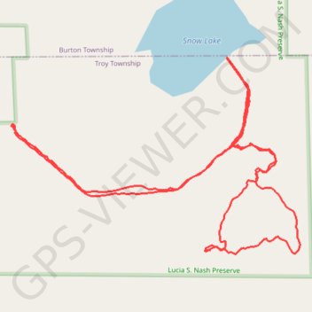
Lucia Nash Preserve, Burton, OH
- Distance: 3.9 Km
- Elevation gain: 29 m
- Maximum elevation: 343 m
- Elevation loss: 29 m
- Minimum elevation: 329 m
- Moving time: 1 h 12 m
- Moving speed: 3.2 Km/h
- Maximum speed: 10.9 Km/h
- Total time: 2 h 8 m
- Global speed: 1.8 Km/h
Interactive trail map
Trail profile
- Distance: 3.9 Km
- Elevation gain: 29 m
- Maximum elevation: 343 m
- Elevation loss: 29 m
- Minimum elevation: 329 m
- Moving time: 1 h 12 m
- Moving speed: 3.2 Km/h
- Maximum speed: 10.9 Km/h
- Total time: 2 h 8 m
- Global speed: 1.8 Km/h
About this trail
Name: Lucia Nash Preserve, Burton, OH trail, distance, elevation, map, profile, GPS track
Start: Snow Lake Trail, Troy Township, Geauga County, Ohio, 44021, United States (41.42407 -81.18131)
End: Snow Lake Trail, Troy Township, Geauga County, Ohio, 44021, United States (41.42408 -81.18132)
Coordinates: 41.42106 -81.18141 41.42568 -81.17236